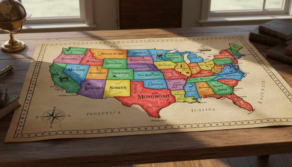
Map of US States – Printable and Interactive Guide
A map of US States serves as the foundational reference for understanding American geography, displaying the political boundaries and spatial relationships of all 50 states from Alabama to Wyoming. These cartographic representations range from simple blank outlines for educational testing to complex labeled versions showing capitals, abbreviations, and regional divisions.
Modern usage spans classroom instruction, travel planning, and demographic analysis. The standard configuration includes 48 contiguous states plus Alaska and Hawaii, each identified by unique two-letter postal codes and capital cities that often differ from their largest metropolitan areas.
Digital and printable formats now offer interactive elements and high-resolution downloads, making state geography more accessible for students, researchers, and travelers seeking accurate territorial representations.
How Many States Are in the US?
- The Union comprises exactly 50 sovereign states, a fixed configuration since 1959.
- Alaska holds the distinction as the largest state by total area, exceeding the combined size of the next three largest states.
- The 48 contiguous states form the primary landmass of North America, excluding the non-contiguous jurisdictions.
- Each state maintains a designated capital city, frequently distinct from its most populous urban center.
- Standardized two-letter postal abbreviations provide uniform identification across federal and commercial systems.
- Five major geographic regions organize the states for statistical and administrative purposes.
- Six inhabited territories exist outside the 50-state structure, appearing on comprehensive maps with distinct designations.
| State | Abbreviation | Capital | Region |
|---|---|---|---|
| Alabama | AL | Montgomery | South |
| Alaska | AK | Juneau | West |
| California | CA | Sacramento | West |
| Delaware | DE | Dover | Northeast |
| Florida | FL | Tallahassee | South |
| Hawaii | HI | Honolulu | Pacific |
| Kansas | KS | Topeka | Midwest |
| New York | NY | Albany | Northeast |
| Texas | TX | Austin | South |
| Wyoming | WY | Cheyenne | West |
Data for this compilation derives from comprehensive state listings. For the complete alphabetical index of all 50 states with corresponding capitals and abbreviations, reference the 50 US States: Complete Alphabetical List with Capitals and Abbreviations.
Where Can I Find a Printable or Interactive Map of US States?
Blank Outline Maps
Educational repositories offer unlabeled state outlines suitable for testing geographic knowledge. Waterproof Paper provides blank maps designed for handwriting practice, while Superstar Worksheets distributes outline versions for classroom matching activities.
Labeled and High-Resolution Options
Labeled versions display state names, capitals marked by stars, and postal abbreviations. These resources appear in colorful PDF formats optimized for standard printing, with some offerings featuring alphabetical abbreviation lists for study purposes.
Interactive Digital Features
Digital platforms now provide Excel-compatible state shapes customizable for dashboards, along with interactive worksheets matching capitals to abbreviations. We Are Teachers curates collections including name-the-state activities and regional bundle resources.
Most printable maps from educational repositories are offered royalty-free for classroom use, though commercial redistribution typically requires specific permission from the content provider.
Additional formats and specifications are catalogued under Printable, Interactive, Blank, Labeled, and High-Resolution Maps.
How to Read and Label a US States Map?
Interpreting Postal Abbreviations
Every state carries a unique two-letter designation standardized by the Postal Service. These codes appear on maps in various formats—sometimes within state boundaries, sometimes as separate keys. Comprehensive lists match each abbreviation to its full state name and capital city.
Identifying Capital Cities
Capital locations typically appear as starred symbols or distinct markers, frequently positioned away from the state’s largest population centers. Sacramento, Tallahassee, and Albany represent capitals that serve as administrative hubs while larger metropolitan areas handle commercial activity elsewhere in their respective states.
Regional Color Coding
Many maps implement color schemes distinguishing the five standard regions: Northeast, Midwest, South, West, and the non-contiguous Pacific states. This visual organization helps users quickly identify geographic relationships between neighboring jurisdictions.
What Are the Key Regions and Features on a US States Map?
The Contiguous Forty-Eight
The term “contiguous United States” refers specifically to the 48 states forming the primary North American landmass, excluding Alaska and Hawaii. Geographic references confirm this distinction remains standard across cartographic resources.
Regional Breakdowns
The Northeast encompasses nine states including Connecticut, Maine, and New York. Regional worksheets divide the West into eleven states spanning from Alaska to Wyoming. Printable charts organize these groupings for educational reference.
Standard projection maps often minimize the relative size of Alaska, which surpasses all other states in total area. Accurate cartographic representations require specific scaling to convey the state’s true geographic magnitude compared to the lower forty-eight.
Territories and Federal Districts
Comprehensive maps may include organized, unincorporated territories: American Samoa (AS), Guam (GU), Northern Mariana Islands (MP), Puerto Rico (PR), and the US Virgin Islands (VI). Washington DC (DC) appears as the federal district, distinct from state sovereignty. High-resolution cartographic resources mark these jurisdictions with distinct symbology.
Puerto Rico, Guam, and other territories maintain distinct postal abbreviations and capital cities, but these jurisdictions do not hold statehood status. Maps including these territories should clearly distinguish them from the 50 sovereign states to avoid administrative confusion.
When Did the Current US State Configuration Become Fixed?
The modern map of US states reached its current composition in 1959 and has remained unchanged since that year. This configuration established the Union at exactly 50 states, with Hawaii positioned as the southernmost state and Alaska recognized as the largest by total area.
- The 50-state configuration stabilized following the admission of the non-contiguous Pacific and Arctic jurisdictions.
- Alaska secured recognition as the largest state, exceeding the combined geographic area of the next three largest states.
- Hawaii established its position as the only state composed entirely of islands, located outside the North American continental shelf.
- The contiguous forty-eight states formed the continuous landmass baseline for standard reference maps.
What Facts About US State Maps Are Definitively Established?
| Established Information | Information Requiring Verification |
|---|---|
|
|
How Did the Current Map of US States Develop?
The contemporary cartographic representation of the United States evolved from territorial expansion and administrative organization spanning two centuries. The current 50-state configuration represents a fixed geographic framework established in the mid-20th century, incorporating both continental and oceanic jurisdictions under a unified federal structure.
Standardization efforts by the Postal Service created the two-letter abbreviation system now universal across maps and official documents. This coding system facilitates mail routing, data processing, and geographic information systems while appearing consistently on educational and reference maps.
Regional categorization emerged from statistical grouping necessities, dividing the nation into Northeast, Midwest, South, West, and Pacific categories. These divisions appear on modern maps to clarify geographic relationships and administrative similarities between neighboring states.
What Sources Provide the Most Reliable US State Map Data?
Alabama (AL) maintains Montgomery as its capital, while Alaska (AK) recognizes Juneau, and Arizona (AZ) operates from Phoenix—establishing the alphabetical foundation for state identification systems.
— The Spreadsheet Guru, comprehensive state listing
The West region encompasses eleven states: Alaska, California, Colorado, Hawaii, Idaho, Montana, Nevada, Oregon, Utah, Washington, and Wyoming.
— Superstar Worksheets, regional geography resources
High-resolution PDFs display colorful state shapes, outlines, and labels suitable for printing, including study maps with states and capitals clearly marked.
— GeoAlliance ASU, cartographic resources
Where Can I Access Complete US State Map Resources?
Comprehensive cartographic resources covering all 50 states, their capitals, and abbreviations remain available through educational repositories and governmental geographic services. For a complete alphabetical listing with corresponding capitals and postal codes, consult the 50 US States: Complete Alphabetical List with Capitals and Abbreviations.
Frequently Asked Questions
What is a map of the US states?
A cartographic representation displaying the political boundaries, geographic positions, and identifying information for all 50 United States, including state names, capitals, and postal abbreviations.
Which US territories appear on state maps but are not states?
Puerto Rico (PR), Guam (GU), American Samoa (AS), US Virgin Islands (VI), and Northern Mariana Islands (MP) appear on comprehensive maps as organized, unincorporated territories.
How do state abbreviations work on US maps?
Two-letter postal codes assigned by the federal government identify each state, appearing either within state boundaries or in accompanying legends and lists.
What is the difference between a capital city and the largest city?
The starred capital represents the official administrative center, often distinct from the state’s most populous metropolitan area which handles commercial rather than governmental functions.
Can blank US maps be used for commercial educational materials?
Most free printable resources allow classroom use, but commercial redistribution typically requires explicit permission from the original content provider.
Why do regional boundaries vary between different US maps?
While the five major regions (Northeast, Midwest, South, West, Pacific) remain standard, specific borderline state classifications may vary depending on the statistical or educational framework used.
What file formats are available for high-resolution maps?
Printable options include PDF documents, Excel-compatible shape files, and PNG/JPG images optimized for standard printing or digital display.
More related posts
 Stuart Pearce: Son’s Tragic Death, Family, Career & Net Worth
 What Is LVT Flooring? Guide to Luxury Vinyl Tiles in Ireland
 Best WiFi Extender UK 2026: PCMag, Telegraph Top Picks
 Michael Franzese: GoodFellas, Net Worth, Why He Skipped Funeral
 David Lynch: Cause of Death, LGBTQ Support, and Legacy
 West Ham News Now: Latest Transfers, Rumours & Club Updates
 Gwyneth Strong: From Only Fools to East Sussex Life